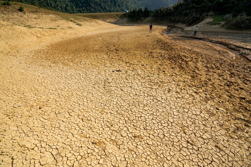
An unusually early and intense warming of the Pacific Ocean is raising concerns about extreme heat, drought, wildfires, storms and food insecurity worldwide
The world is heading towards an exceptionally strong El Niño, with scientists warning that the rapidly developing climate phenomenon could intensify extreme weather and compound the effects of global warming.
The United Nations has identified the growing threat of extreme weather as part of a broader global climate emergency. Current observations indicate that the developing El Niño is unusually intense and has emerged earlier than expected, raising concerns about its potential influence on weather patterns through 2027.
El Niño is a naturally occurring climate phenomenon driven by changes in ocean temperatures and atmospheric circulation across the tropical Pacific. Although it originates in the Pacific Ocean, its effects can extend across continents, influencing rainfall, temperature, drought, tropical cyclones and wildfire conditions.
The current event is attracting particular attention because of its rapid development and exceptional warmth.
An unusually strong El Niño
Scientists monitor El Niño using measurements of sea-surface temperatures in the tropical Pacific near the equator. Traditionally, the intensity of the phenomenon was assessed by comparing observed temperatures with historical averages.
Weather agencies, including the Australian Bureau of Meteorology, increasingly use indices that account for the long-term warming of the planet. Such approaches help distinguish the effects of natural climate variability from the rising background temperatures associated with climate change.
Recent observations show that the current El Niño is already displaying unusual characteristics.
El Niño events generally reach their strongest phase between November and January. The current event, however, has developed unusually early and is already producing exceptionally warm conditions before its expected seasonal peak.
Recent measurements have placed the relevant temperature index at around 2.3°C above average for August, putting the event among the strongest observed El Niños.
The combination of rapid development, elevated ocean temperatures and a warming global climate has heightened concerns about the scale of its impacts.
Weather patterns already shifting
The strongest and most immediate effects of El Niño are generally felt across countries bordering the Pacific, but atmospheric changes can influence weather patterns thousands of kilometres away.
Indonesia has already faced severe wildfire conditions, with extensive fires fuelled by hot and dry weather. El Niño can reduce rainfall across parts of Southeast Asia, drying vegetation and increasing the likelihood that fires will spread.
The phenomenon can also alter the distribution and intensity of tropical cyclones.
Warmer waters in the central and eastern Pacific generally provide more favourable conditions for cyclone development in those regions during El Niño years. Multiple tropical cyclones have recently been active across the Pacific, an unusual pattern stretching from waters near Japan towards Hawaii.
Such changes demonstrate how a shift in ocean temperatures can reorganise atmospheric circulation and influence weather systems over a vast area.
Australia faces a hotter, drier season
Australia is particularly sensitive to El Niño because the phenomenon is frequently associated with hotter and drier conditions across large parts of the country.
The Australian Bureau of Meteorology has identified signs consistent with a typical El Niño response. Temperatures have been rising, with parts of northern Australia experiencing temperatures approaching 37°C unusually early in the season.
Eastern and central parts of the country could face drier-than-normal conditions through spring and summer. Reduced rainfall combined with higher temperatures could increase pressure on water resources, agriculture and ecosystems while raising the risk of bushfires.
However, El Niño does not produce identical conditions during every event. Historical experience shows considerable regional variation.
The strong El Niño of 1982 was associated with severe dry conditions in parts of Australia. During the 1997–98 and 2015–16 events, some Australian regions experienced substantial rainfall while others remained comparatively dry.
This variability makes regional forecasting particularly important as the current event strengthens.
Climate change could amplify the effects
The significance of the current El Niño extends beyond natural climate variability.
Scientists are increasingly examining how El Niño interacts with a warmer atmosphere and ocean. Climate change has already increased global temperatures, altered rainfall patterns and contributed to more frequent or severe extremes in many regions.
A strong El Niño can temporarily push global temperatures even higher by transferring heat from the ocean into the atmosphere. This raises the possibility that global temperature records could again be challenged as the event reaches its peak and its influence continues into 2027.
The combination of natural warming from El Niño and human-driven warming from greenhouse-gas emissions could place additional stress on ecosystems, agriculture and vulnerable communities.
Food security under pressure
One of the greatest concerns is the potential impact on food production.
Changes in rainfall and temperature can disrupt planting seasons, reduce crop yields and increase livestock stress. Flooding in parts of South America could damage agricultural land, while prolonged drought in parts of Africa could threaten harvests and water supplies.
The United Nations has warned that climate extremes can disproportionately affect vulnerable populations, particularly communities that depend heavily on agriculture and have limited access to food, water and financial resources.
Millions of people could therefore face worsening food insecurity if droughts, floods and other climate extremes occur simultaneously across major agricultural regions.
Greater investment in climate research needed
The growing uncertainty surrounding the precise regional effects of an exceptionally strong El Niño has highlighted the need for improved climate modelling and forecasting.
Institutions such as the World Meteorological Organization, the Australian Bureau of Meteorology and national climate agencies have an important role in monitoring ocean temperatures, atmospheric circulation and emerging weather patterns.
Better forecasting could help governments prepare for droughts, floods, wildfires and agricultural disruptions before their impacts become severe. It could also allow communities and farmers to adapt planting, water management and emergency-response strategies.
For Australia and other regions experiencing rapid climate change, scientists face the additional challenge of understanding how an unusually strong El Niño will interact with long-term global warming.
The developing El Niño is therefore more than a short-term change in Pacific Ocean temperatures. It is becoming an important test of the world’s ability to prepare for overlapping climate extremes.
While El Niño itself is a natural phenomenon, the increasingly warm climate in which it is occurring is largely the result of human greenhouse-gas emissions.
The event could intensify existing pressures on people and ecosystems, but it also provides another reminder of the need for stronger climate preparedness, better scientific forecasting and faster reductions in fossil-fuel emissions.
As the Pacific continues to warm and the El Niño approaches its seasonal peak, governments and communities around the world are likely to face a difficult period of heat, drought, flooding, storms and growing pressure on food systems.


 PARYAWARAN
Leave a comment